


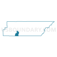
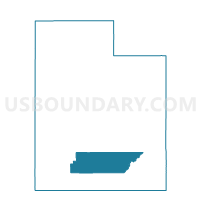
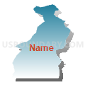
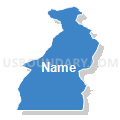
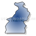
Henrieville Voting District, Garfield County, Utah
About
Outline

Summary
| Unique Area Identifier | 678843 |
| Name | Henrieville Voting District |
| County | Garfield County |
| State | Utah |
| Area (square miles) | 103.02 |
| Land Area (square miles) | 102.89 |
| Water Area (square miles) | 0.13 |
| % of Land Area | 99.87 |
| % of Water Area | 0.13 |
| Latitude of the Internal Point | 37.66753170 |
| Longtitude of the Internal Point | -111.91161800 |
Maps

Graphs
Select a template below for downloading or customizing gragh for Henrieville Voting District, Garfield County, Utah


Neighbors
Neighoring Voting District (by Name) Neighboring Voting District on the Map
- Bullfrog Voting District, Kane County, UT
- Cannonville Voting District, Garfield County, UT
- Escalante Voting District, Garfield County, UT
- Tropic Voting District, Garfield County, UT
Top 10 Neighboring County Subdivision (by Population) Neighboring County Subdivision on the Map
- Kanab CCD, Kane County, UT (5,697)
- Tropic CCD, Garfield County, UT (1,439)
- Escalante CCD, Garfield County, UT (1,258)